as the title says. i think there are 11, though i probably can’t even remember all of the ones i made.
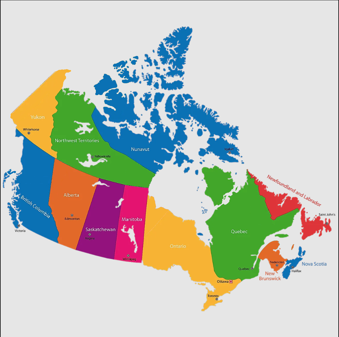
Most of these are more subtle than for example the recent US states one, it might be a bit harder to spot all of them.
as the title says. i think there are 11, though i probably can’t even remember all of the ones i made.
Most of these are more subtle than for example the recent US states one, it might be a bit harder to spot all of them.
Idk canada that well, so I only see the missing PEI, idk about wonky borders or stuff
I think nunavut is being swallowed
NWT-Nunavut border looks wrong
PEI is gone
Is Manitoba too thin? I can’t see anything else other than those things and I can’t tell if some things look wrong because it’s not mercator
Wdym new brunswick is gone? It’s right there
I was confused because the marker was in the water (maine)
as an united states of american, i am so sorry for the canadians in this forum
i only know about the existence of british columbia and quebec. thus this means that according to my brain, the entire left half of canada belongs to british columbia, and the right half belongs to the french.
It seems that New Brunswick took a bite out of Quebec as well as Quebec taking a part of Labrador
Edit: Is the northwest of Quebec drifting away??
Edit 2: I know for a FACT Regina is not that for west in Saskatchewan
Edit 3: I think Northwest Territories lost its islands to Nunavut and then proceeded to steal southern Nunavut
Edit 4: Ontario decided to conquer eastern Manitoba
You’re good but that’s still not all of them
I’m genuinely surprised you’re the first one to notice the massive quebec island
But there are (at least) 3 more, though one is basically impossible without direct comparison